实现不同尺寸和不同波段数的图像叠加(layerstaking)——按地理位置对准GDAL,Numpy
时间:2023-09-21 21:07:02
遥感图像叠加,网格图像叠加,不同尺寸和波段数
背景
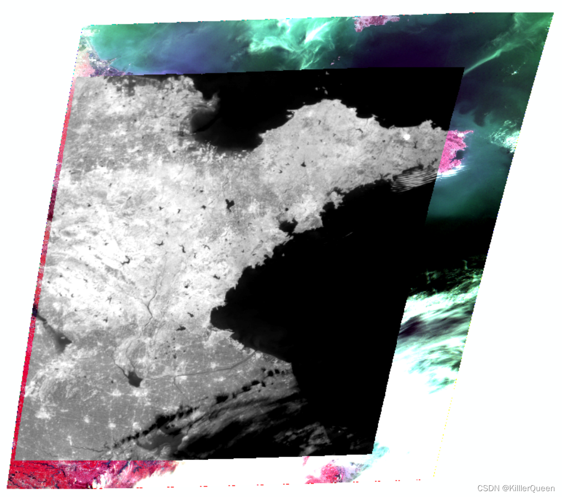
高分4号卫星配备了两个不同的传感器PMS数据包含5个波段,IRS只有一个中红外波段,它们的尺寸和数量不同,IRS数据包含在PMS内部数据。叠加效果如下图所示:
思路
考虑到它们的左上角不对齐,如果你想实现波段叠加,你不能直接叠加它们的数据矩阵,否则它们将不可避免地错位。但要找到它IRS左上角在PMS相应的位置(x,y),然后写同PMS一样大的array中。
代码实现
def layerstaking(PMS,IRS,merge):     "根据地理位置对准不同尺寸和波段数的图像叠加"     "针对高分4号PMS和IRS数据"     "输入图像1(上层),输入图像2(下层),输出文件名称"     # 读取     IRS_ds = gdal.Open(IRS)     IRS_geotrans = IRS_ds.GetGeoTransform()     IRS_lefttop_x,IRS_lefttop_y = IRS_geotrans[0],IRS_geotrans[3]     IRS_cols = IRS_ds.RasterXSize     IRS_rows = IRS_ds.RasterYSize     IRS_array = IRS_ds.GetRasterBand(1).ReadAsArray()     PMS_ds = gdal.Open(PMS)     PMS_cols = PMS_ds.RasterXSize     PMS_rows =PMS_ds.RasterYSize     PMS_geotrans = PMS_ds.GetGeoTransform()     PMS_lefttop_x, PMS_lefttop_y ,PMS_x_res, PMS_y_res = PMS_geotrans[0], PMS_geotrans[3], PMS_geotrans[1], PMS_geotrans[5]     # 计算IRS在PMS中间的相对位置,即行列号     x_situ = int(abs((PMS_lefttop_x-IRS_lefttop_x)/PMS_x_res))     y_situ = int(abs((PMS_lefttop_y-IRS_lefttop_y

       )
       /PMS_y_res
       )
       )
       # 创建与PMS同样尺寸的图层来存储IRS new_band
       = np
       .full
       (
       [PMS_rows
       , PMS_cols
       ]
       ,
       -
       999.
       )
       # 将IRS数据放入对应位置 new_band
       [y_situ
       :
       (y_situ
       +IRS_rows
       )
       , x_situ
       :
       (x_situ
       +IRS_cols
       )
       ]
       = IRS_array
       # 数据写出 Driver
       = PMS_ds
       .GetDriver
       (
       ) nbands
       = PMS_ds
       .RasterCount
       +
       1 out_name
       = merge outDataset
       = Driver
       .Create
       (out_name
       , PMS_cols
       , PMS_rows
       , nbands
       , gdal
       .GDT_Float32
       )
       for m
       in
       range
       (nbands
       -
       1
       )
       :
       # PMS ReadBand
       = PMS_ds
       .GetRasterBand
       (m
       +
       1
       ) outband
       = outDataset
       .GetRasterBand
       (m
       +
       1
       ) outband
       .SetNoDataValue
       (
       -
       999
       ) Image
       = ReadBand
       .ReadAsArray
       (
       ) outband
       .WriteArray
       (Image
       ) outDataset
       .GetRasterBand
       (
       6
       )
       .WriteArray
       (new_band
       )
       # IRS outDataset
       .FlushCache
       (
       ) outDataset
       .SetGeoTransform
       (PMS_ds
       .GetGeoTransform
       (
       )
       ) outDataset
       .SetProjection
       (PMS_ds
       .GetProjection
       (
       )
       )
       print
       (
       "end"
       )
       del IRS_ds
       , PMS_ds
       , outDataset
工具
基于python,GDAL, Numpy
完成后的波段组合显示效果,位置精确,达到想要的效果


